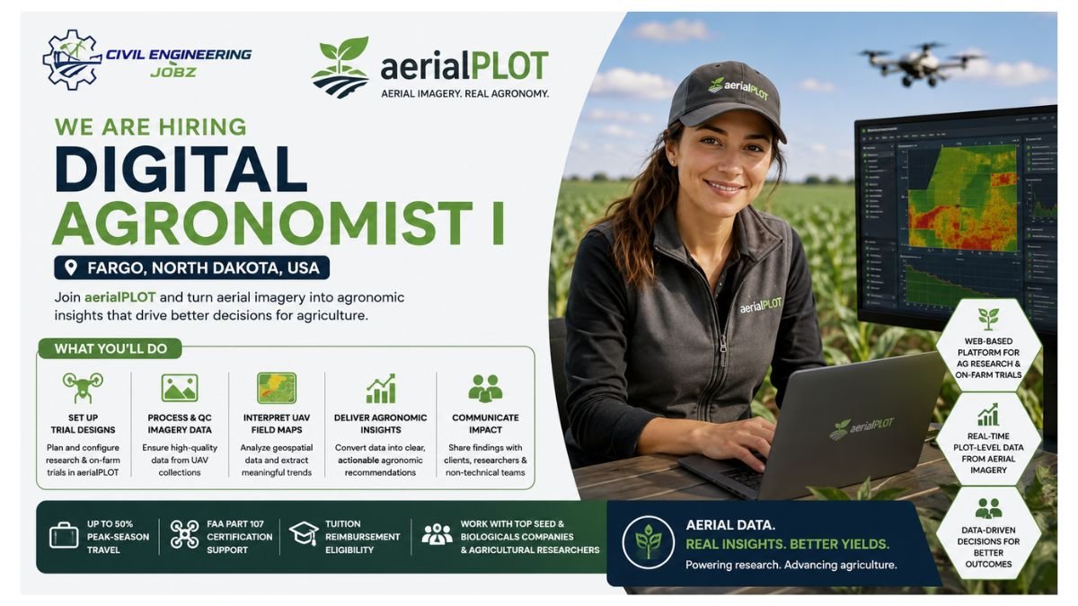
aerialPLOT — a pioneering web-based software platform for agricultural research and on-farm evaluations — is hiring a data-driven Digital Agronomist I for its core analytics team in Fargo, North Dakota. In this role, you will set up trial designs, process and QC imagery-derived data, interpret UAV-collected field maps, and translate raw geospatial outputs into agronomic insights that clients can act on. Working with seed companies, biologicals companies, and agricultural researchers, you will use the aerialPLOT platform to turn aerial imagery into plot-level data in real time — and communicate findings clearly to both technical and non-technical audiences. The role includes up to 50% peak-season travel, FAA Part 107 certification support, and tuition reimbursement eligibility for recent graduates.
About aerialPLOT — Precision Agriculture Analytics Platform
Platform: Web-based software automating extraction of data from aerial UAV imagery at operational scale — eliminating manual labour and subjectivity from agricultural research
Clients: Agricultural researchers, seed companies, biologicals companies — needing plot-level data analysis in real time across the growing season
Role Base: Fargo, North Dakota — core analytics team, primarily platform and analysis work with up to 50% peak-season field travel
FAA Part 107: Employer pays for training and FAA Part 107 Knowledge Exam — required within the first month of employment
Recent Grads: May qualify for tuition reimbursement through North Dakota state workforce programs — eligibility discussed during interview
Why This Digital Agronomist Role at aerialPLOT Stands Out
Cutting-Edge AgTech: Work at the intersection of precision agriculture, UAV remote sensing, and data analytics — a uniquely future-facing career in the fast-growing ag technology sector
Real Analytical Ownership: You are not just collecting data — you are interpreting field maps and turning them into insights that directly shape seed and biologicals companies’ research decisions
FAA Part 107 Paid: Employer fully funds your FAA Part 107 Remote Pilot training and exam — adding a valuable professional aviation credential to your career portfolio
Tuition Support: Recent graduates may qualify for North Dakota state tuition reimbursement — a genuinely rare and valuable additional benefit
Position Overview
As Digital Agronomist I at aerialPLOT in Fargo, you will sit at the fascinating intersection of agronomy, data science, and UAV remote sensing — turning raw imagery-derived geospatial datasets into actionable agronomic intelligence for seed companies, biologicals companies, and agricultural researchers. Your day-to-day work inside the aerialPLOT platform includes setting up trial designs, processing and quality-controlling imagery-derived data, interpreting field maps, and communicating findings — both the clean successes and the messy, incomplete datasets that demand practical problem-solving — in ways that clients and internal teams can readily understand and act upon. During peak season, you will travel to trial sites across the region for setup, field checks, and client support. The rest of the year, you are at your desk in Fargo making sense of everything the drones brought back from the field — and ensuring every dataset tells the clearest, most accurate agronomic story it can.
Why This Role Matters: As Digital Agronomist I at aerialPLOT, you are solving one of the most persistent challenges in modern agricultural research — the gap between the data a drone can collect and the insight a researcher, seed company, or farmer can actually use to make better decisions. By interpreting imagery-derived field maps, identifying what the data shows about crop performance, varietal response, and field variability, and translating those findings into structured, actionable recommendations, you are helping the agricultural industry learn more from every trip to the field — and ultimately contributing to a more data-driven, productive, and sustainable future for farming across the United States and beyond.
Key Responsibilities
Trial Design Setup & Data QC — aerialPLOT Platform
- Set up and configure trial designs within the aerialPLOT platform — including plot layout, treatment mapping, and data structure setup for small plot research trials from seed and biologicals company clients
- Process and quality-control imagery-derived data outputs — identifying and resolving data anomalies, incomplete records, and spatial errors in UAV-collected geospatial datasets with practical, evidence-based solutions
- Work systematically with large, sometimes messy or spatially incomplete geospatial datasets — developing structured, repeatable workflows that improve data quality and analytical consistency across client trials
- Maintain accurate trial records and data documentation throughout the growing season — ensuring platform data is complete, current, and reliable for both internal review and client-facing reporting purposes
Field Map Interpretation & Agronomic Insight Delivery
- Interpret UAV-collected field maps and imagery-derived data — reading spatial patterns in NDVI, canopy cover, stand count, biomass, and other remotely sensed vegetation parameters with strong agronomic contextual understanding
- Translate raw geospatial outputs into structured agronomic data and actionable client insights — clearly explaining what field variability, treatment response differences, and crop performance patterns mean for trial conclusions
- Communicate complex technical findings to both agronomy-specialist clients and non-technical stakeholders — calibrating the depth and language of analysis reports to match each audience’s background and needs
- Collaborate with client success team members to ensure all trial data is accurate, timely, and presented in a format that genuinely supports the client’s decision-making throughout the growing season
UAV Field Support, Travel & Peak Season Operations
- Collect UAV aerial imagery as needed to support the team during peak season — working alongside aerialPLOT’s internal drone pilot network to ensure comprehensive, timely field data collection at assigned trial sites
- Travel up to 50% during peak growing season — including overnight stays, walking uneven and rough field terrain, and physically supporting trial setup, in-season field checks, and client site visits
- Within the first month of employment, take and pass the FAA Part 107 Knowledge Exam and obtain a Remote Pilot Rating for UAS commercial operations — with training and exam cost fully covered by aerialPLOT
- Physically lift up to 50 lbs of field equipment during site visits — and maintain the physical readiness, independence, and organizational discipline required to manage multi-site peak-season field schedules effectively
Client Support, Cross-Team Collaboration & Problem-Solving
- Support the client success team by answering data and trial-design questions from researchers and seed/biologicals company clients — providing clear, technically accurate, and practically useful responses in a timely manner
- Collaborate with local and global aerialPLOT teams on trial design strategy, data analysis approaches, and platform development feedback — contributing field-level and analytical insights to product and process improvements
- Work independently and manage multiple concurrent deliverables with limited day-to-day guidance — demonstrating the self-direction, organizational discipline, and problem-solving initiative required in a dispersed team structure
- Proactively identify patterns, anomalies, and analytical challenges across the trial data portfolio — sharing findings with the analytics team and suggesting practical workflow improvements where opportunities arise
Qualifications & Requirements
Educational Requirements
- Bachelor’s degree or Master’s degree in Agronomy, Plant Science, Soil Science, Environmental Science, Crop Science, or a closely related agricultural or biological sciences discipline
- Recent graduates may qualify for tuition reimbursement through North Dakota state workforce programs — aerialPLOT will walk eligible candidates through the process during the interview
Experience & Background
- Experience with small plot research trials — including trial design, plot layout, treatment randomization, data collection protocols, or statistical analysis relevant to seed, crop, or agronomic research
- Strong academic or professional background in agronomy, soil science, plant science, or crop research — with the ability to apply that agronomic knowledge to the interpretation of imagery-derived field map data
- Demonstrated ability to read, interpret, and translate field maps into structured, meaningful data — comfortable working with spatial variability, treatment response patterns, and agronomic observations from field imagery
- Experience with aerial imagery, UAV remote sensing, or geospatial data is a meaningful plus — but not required for candidates with strong agronomic and analytical fundamentals
Technical Skills
- Desired familiarity with GIS software (ArcGIS, QGIS, or equivalent) — for spatial data analysis, map review, and geospatial dataset management relevant to agricultural trial environments
- Desired working knowledge of Python or R for data manipulation, statistical analysis, and workflow automation in an agricultural research or geospatial data context
- Excellent communication skills — written and verbal — to clearly explain technical geospatial and agronomic findings to both specialist agronomists and non-technical clients or stakeholders
Mandatory Requirements
- Must be 21 years of age or older, hold a valid US driver’s license, and maintain a clean driving record — background check required as a condition of employment
- FAA Part 107 Remote Pilot certification must be obtained within the first month of employment — aerialPLOT fully covers training materials and exam fees for all new team members
- Physical ability to travel up to 50% during peak season, walk rough agricultural field terrain, and lift field equipment up to 50 lbs — comfortable working in outdoor agricultural environments in varying weather conditions
About aerialPLOT — The Future of Agricultural Research Analytics
aerialPLOT is a web-based software platform purpose-built for agricultural research and on-farm evaluations — automating the extraction of plot-level data from aerial UAV imagery at operational scale to eliminate the manual labour, subjectivity, and inefficiency that have long constrained agricultural research data workflows. The platform gives seed companies, biologicals companies, and agricultural researchers a single portal to analyze, manage, and share plot-level trial data in real time across the entire growing season — enabling them to learn more from every trip to the field and make better, faster data-driven decisions about crop performance, varietal selection, and product efficacy. Based in Fargo, North Dakota — at the heart of one of America’s most productive agricultural regions — aerialPLOT is building the team, technology, and analytical capability to become the standard platform for precision agricultural research analytics across the United States and beyond. Join aerialPLOT’s analytics team as Digital Agronomist I and become part of the future of data-driven farming.
Apply Now: If you are an analytically-minded agronomy professional who loves making sense of field data and wants to apply your skills at the cutting edge of agricultural technology, aerialPLOT in Fargo, ND is waiting for you.
Who Should Apply?
- Agronomy & Plant Science Graduates: With a Bachelor’s or Master’s in Agronomy, Plant Science, Soil Science, or Crop Science — and a genuine interest in precision agriculture, UAV remote sensing, and imagery-derived data analytics
- Agricultural Research Technicians: With small plot trial experience — trial design, data collection, or analysis — who are ready to apply that knowledge in a technology-first agricultural analytics platform environment
- GIS & Geospatial Agriculture Analysts: With GIS, Python, or R experience in an agricultural or environmental science context — comfortable with large, complex spatial datasets and agronomic field data interpretation
- UAV / Drone Agronomy Enthusiasts: With an interest in aerial imagery, remote sensing, and precision agriculture technology — willing to obtain FAA Part 107 certification and contribute to drone-supported field data collection
- Recent North Dakota Graduates: Seeking their first full-time agronomy analytics role in Fargo — potentially eligible for North Dakota state tuition reimbursement, FAA Part 107 certification, and meaningful early-career data science experience

Recently opened JOBS 👇🏻
Agriculture Sales Manager Jobs USA 2026
Agriculture Specialist Jobs United States 2026
Agriculture Relationship Manager Jobs Marshall MN 2026